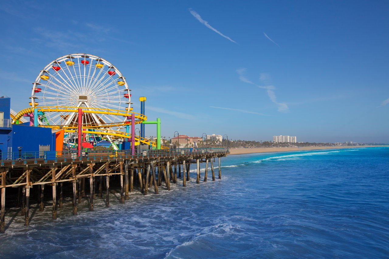
As of the last public reports, the blue neon arch over the Pier entrance at Ocean and Colorado was still standing. On Sept. 24, Patch reported that the sign remained in place and that a City spokesperson had confirmed no removal date. Four days later, crews closed the road that runs underneath it. The Moomat Ahiko Way on- and off-ramps to Pacific Coast Highway have been shut since Monday, Sept. 28. They are scheduled to stay closed until Nov. 28 while crews demolish the last section of the old bridge and start foundation work for the new one.
The sign will draw the photographers and the news crews. For anyone who uses Ocean Avenue to reach PCH, though, the bigger story this fall is the closed road under it. The City's own schedule for this project has already moved more than once, so the posted dates are worth reading as targets.
The road under the sign
Moomat Ahiko Way is a short road with a long history. It used to be part of State Route 187, and it runs north-south between Ocean Avenue and PCH, passing under the Pier. The name was first presented as a Chumash phrase in 2004. City staff later checked with the Gabrielino Tongva Tribal Council and confirmed it is Tongva for "Breath of the Ocean."
The road has closed for short stretches before. The Santa Monica Daily Press reports that this closure will last far longer than any earlier one. It also covers the largest piece of bridge demolition since the project began, and crews will use the closed road to stage equipment. The City's posted detours work like this:
- Southbound PCH: keep going onto eastbound I-10 and exit at Lincoln Boulevard. The Daily Press also lists the California Incline as an exit.
- Ocean Avenue to PCH: go north to the California Incline.
Nobody has published traffic counts for Moomat Ahiko Way. City reports have described it as running at or near capacity for years. For context, Caltrans reported 60,000 to 85,000 cars a day on PCH through Santa Monica before the pandemic. More recently, Caltrans estimated about 47,000 daily trips on the stretch that closed after the Palisades Fire. Some share of that traffic used to drop onto Ocean Avenue by the Pier. For the next two months it has to find another way, and the City's guidance is to allow extra travel time.
Why a 1939 bridge needed this much work
The Works Progress Administration built the Pier bridge in 1939. By the time it was slated for replacement, it scored 8.2 on a 100-point federal sufficiency scale. Bridges below 50 qualify for federal replacement money. The Daily Press describes cracked and delaminated concrete exposing corroding steel, which would make the bridge unsafe in a major earthquake. It is also the only vehicle connection between the Pier and city streets.
The cost grew with each delay. Officials estimated $8 million in 2010, $27.2 million in 2021, and $29 million in 2022. In 2025 the City Council awarded Shimmick Construction Co. a contract of up to $35,579,292, which includes a 20% contingency on a $29.6 million low bid. The council also approved $4.9 million for construction management by Bureau Veritas. The Federal Highway Bridge Program covers $30.2 million, about 75%. The rest comes from local transportation sales tax funds, including Measures M and R and Proposition C.
That federal share helps explain the design. The Daily Press notes that the final plan lacks the looks and features of earlier proposals. It is the version that was fully funded, and it started with the goal of finishing before the 2028 Olympics.
The dates to plan around
The ramp closure overlaps with several shorter closures around the Pier and with a full fall calendar elsewhere in the city. In order:
- Oct. 3: The Montana Avenue Art Walk closes Montana between 7th and 17th streets from 4 a.m. to 11 p.m.
- Oct. 5–6: The outside southeast lane and the bike lane at Ocean and Colorado close from 5 a.m. to 1 p.m. for signal work. At least one vehicle lane stays open, and cyclists follow posted detour signs.
- Oct. 5–9: Appian Way closes to all vehicles under the Pier bridge so crews can install shoring. Cars reach Pier parking through PCH instead. The City points drivers to Beach Lot 4 South, Beach Lot 3 North, and Parking Structure 8.
- Oct. 10: Santa Monica Block Fest returns to all three blocks of the Third Street Promenade from 2 p.m. to midnight.
- Oct. 18: The Main Street Block Party, with Day of the Dog, closes Main Street between Pier Avenue and Pacific Street from 5 a.m. to 10 p.m.
- Nov. 1: Día de los Muertos on the Pier.
- Nov. 14: The next Block Fest, followed by Dec. 12.
- Nov. 28: The scheduled end of the Moomat Ahiko Way ramp closure.
The Pier's own events continue alongside the work. Locals' Night runs on third Thursdays from September through May, and Holiday Cheer programming is set for December. The Pier's event listing does not mention any cancellations tied to construction. The City says the Pier stays open throughout, including its restaurants, shops, and attractions, and that people on foot can still reach the Pier and Ocean Front Walk. For the Pier, the City points to local bus routes and the Metro E Line as alternatives to driving.
Walkers and runners should also expect short stops on Ocean Front Walk. Crews close the path under the bridge off and on during weekday work hours, 5 a.m. to 1 p.m., with flaggers routing pedestrians around the work. The City says these closures will continue throughout construction. Construction runs on weekdays during those same hours near Ocean and Colorado, and the City warns that the drilling may be loud.
When the sign actually comes down
The removal date has been described three different ways. On Sept. 22, KTLA reported that the sign was expected to come down by the end of September. Two days later, the Daily Press said removal would happen in October or November. The City's project page says only "fall 2026."
When removal does happen, the City's FAQ describes the steps. Crews will disconnect the power, take out and crate the neon tubes, and lift off the Crown Sign by crane. Then they will lower the arched truss and columns into steel shipping frames and load everything onto separate flatbeds bound for Las Vegas. YESCO, the company that has restored the "Welcome to Fabulous Las Vegas" sign, will handle the work. That includes new neon tubing, rust removal, repainting, and structural repairs.
The sign has more history than most people realize. The Pan Pacific Neon Sign Company designed it, it was unveiled on June 17, 1941, and it is listed on the California Register of Historical Resources. The City puts it plainly in the FAQ:
"The sign is not being removed permanently or replaced. It is being refurbished and its historic character will remain intact."
While the original is away, a half-scale replica stands on the Pier. Head down the bridge, and just before Pier Burger it is on your left, with the Pacific Park roller coaster behind it. It lights up at night. When the restored sign comes back, it will sit about 10 feet north of its current spot and higher than before, to make it easier to see and give vehicles more clearance.
A schedule that has already moved
There's a reason to treat Nov. 28 as a target date. In December 2025, the City expected to remove the sign in January 2026. It planned demolition for May through August 2026 and new bridge construction from August 2026 through December 2027. A revised schedule in February 2026 pushed demolition to June through September. It placed foundation work from July through December, new bridge construction from October 2026 to August 2027, parking-lot restoration from June to September 2027, and completion in December 2027. Demolition of the final section is now running into late November, two months past the September end in the revised plan.
The City has not published a new completion date to replace the December 2027 target. Its project page now says only that the bridge is meant to be finished before the 2028 Summer Olympics. The sign FAQ expects the sign back when construction ends, which it puts in late 2027. Right now, the crews are drilling holes for the foundation, starting at the base of the Pier and working toward Ocean Avenue, then filling them with steel rebar and concrete to form columns.
The finished bridge will be 447 feet long and 39 feet wide. It will have a 15-foot sidewalk on the south side and a 20-foot roadway on the north side that cars and bicycles share, and it is designed for a 75-year service life. The published design doesn't include a separate bike lane. For cyclists, the bigger change is the wider sidewalk, which the City's FAQ presents as an improvement for both pedestrians and bicyclists. The City posts updates on its Pier bridge project page, and that page is the best place to check before the ramps are scheduled to reopen.
A restoration like YESCO's starts with an inspection: what's sound, what has worn out, and what has to be rebuilt so the piece lasts another few decades. Johannes Steinbeck uses the same craftsman's approach when he looks at a home near Ocean Avenue, including how long construction nearby affects its access and appeal. If you'd like a clear read on your own property while the bridge goes up, Steinbeck Homes can prepare a valuation for you. Request a Home Valuation.